
• 088 77 44 000
  • office@gis-infra.bg
  • Inquiry
  • Home
  • About us
    • Implemented projects
    • Clients and Partners
    • Frequently Asked Questions
  • Activities
    • Feasibility study
    • Spatial planning
    • Investment design
  • Services
    • Geodesy and Cartography
    • Cadastre and Regulation
    • Road design
    • Agricultural land
  • Blog
  • Contacts
  • Language: English
    • Български Български
    • English English

Blog

  • Home / Archive by category "Blog"
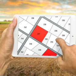
§ 4 Lands under the Agricultural Land Ownership and Use Act (ALOUA) – Specific Features and Practical Issues
  • 18.08.2026
  • Blog

1. What are “§ 4 lands”? Generally speaking, these are agricultural lands that were formerly allocated by the State to individuals for use, most commonly…
Continue Reading
Agricultural Land under Article 19 of the Agricultural Land Ownership and Use Act – What You Need to Know
  • 04.07.2026
  • Blog

More than three decades after the process of restoring agricultural land ownership began in Bulgaria, there are still owners and heirs whose ownership rights have…

Continue Reading
How to Change the Permanent Land Use Type of Agricultural Land
  • 14.05.2026
  • Blog

Changing the Permanent Land Use Type (PLUT) is an administrative procedure that allows the way agricultural land is used to be changed without changing its…

Continue Reading
Minimum Distances for Planting Trees Near the Boundary with a Neighboring Property
  • 29.03.2026
  • Blog

Restrictions on ownership constitute specific prohibitions on carrying out certain actions addressed to the owner of a given property. One such restriction of property rights…

Continue Reading
Indicators for Spatial Planning and Development of Land Properties
  • 20.02.2026
  • Blog

Indicators for spatial planning and land development are key parameters that determine how and to what extent a particular land property or territory may be…

Continue Reading
Land Plot Subdivision and Partition
  • 24.01.2026
  • Blog

The subdivision (partition) of a land plot represents a legal procedure by which one immovable property is divided into two or more separate land plots….

Continue Reading
Certificate of Tolerability of Buildings
  • 11.01.2026
  • Blog

A building is unlawful when it is carried out: in non-compliance with the provisions of the applicable detailed development plan and without construction documentation; without…

Continue Reading
Requirements for the Regulation and Development of Land Plots
  • 03.01.2026
  • Blog

Regardless of whether land plots are regulated pursuant to the general rule of Article 17(1) of the Spatial Development Act (SDA), i.e. along existing property…

Continue Reading
Boundaries of a Land Plot and of a Regulated Land Plot (RLP)
  • 23.11.2025
  • Blog

The Cadastre and Property Register Act (CPRA) introduced the term “land plot.” Under this Act, a land plot is a part of the Earth’s surface,…

Continue Reading
Errors in the Transformation of Land Restitution Maps into a Cadastral Map
  • 25.10.2025
  • Blog

In the course of procedures for the preparation of cadastral maps and cadastral registers for urbanised territories, errors and inconsistencies increasingly emerge between the boundaries…

Continue Reading

Did you know?

GIS-Infra Ltd. holds all necessary licenses and insurance required to provide services in the fields of geodesy, cadastre, spatial planning, and investment design.

About us

  • Implemented projects
  • Clients and Partners
  • Frequently Asked Questions

Our services

  • Geodesy and Cartography
  • Cadastre and Regulation
  • Road design
  • Agricultural land

Latest Publications

  • § 4 Lands under the Agricultural Land Ownership and Use Act (ALOUA) – Specific Features and Practical Issues
  • Agricultural Land under Article 19 of the Agricultural Land Ownership and Use Act – What You Need to Know
  • How to Change the Permanent Land Use Type of Agricultural Land
  • Minimum Distances for Planting Trees Near the Boundary with a Neighboring Property
  • Indicators for Spatial Planning and Development of Land Properties
Top

Useful links

  • Our services
  • Frequently Asked Questions
  • Blog
  • Contacts
  • Privacy Policy
  • Cookie Policy

Partners

  • SOFIA MUNICIPALITY
  • MUNICIPALITY OF BOTEVGRAD
  • SGI ARCHITECTS
  • HUS INVEST
  • GBS

To contact us

  • Sofia, 18 Belmeken Street, entrance A
  • 088 77 44 000 ; 02 44 04 000
  • office@gis-infra.bg
  • 8:00 - 18:00

Follow us

© 2026 - gis-infra.bg

Website development by SavovDesign

Website gis-infra.bg uses cookies in order to better provide its services. See more »Understood